Lie of the Land
This aerial view looks west down the main street of the village. House frontages face each other across a beck that runs east to west between access roads on either side. The main road enters from the direction of Garrowby Hill to the north (right side of the photo) and exits in the direction of Pocklington to the south (left side of the photo).
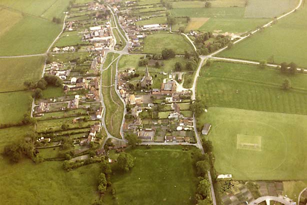
In the centre foreground is the site of the Archbishops' Palace with its moat just visible on two sides. Just above the very centre of the view you'll see St Edith's Church.
The distinctive rectangular marking with surrounding ring in the bottom right quadrant is the cricket pitch on the village playing field (which now houses the new Hall & Sports Pavilion which opened in 2010)
If you are more interested in Bishop Wilton in the present rather than the past, go to www.bishopwilton.com
To see Bishop Wilton in relation to surrounding villages follow this link to multimap.com.
(c) Copyright 2009 Contributors. All rights reserved. |