PocklingtonHistory.com Railway Street (Circa 1880)
News
> AGM report 2012
> Field Walking talk
> Food Workshop
Events
> Pocklington History Group
  4th Jun. - Queens Jubilee Exhibition

> Wetwang Local History Group
  12th Jun. - Gt. Wold Valley Proj.

> Wetwang Local History Group
  30th Jun. - Rudston Church visit

Gallery
Market Place Market Place
Note the new building in the photo on the corner.
Regent Street Regent Street
Note the 'Old Red Lion Hotel'
Chapmangate Chapmangate
Note the independent chapel built in 1807 to the left.
1855 William Watson Map
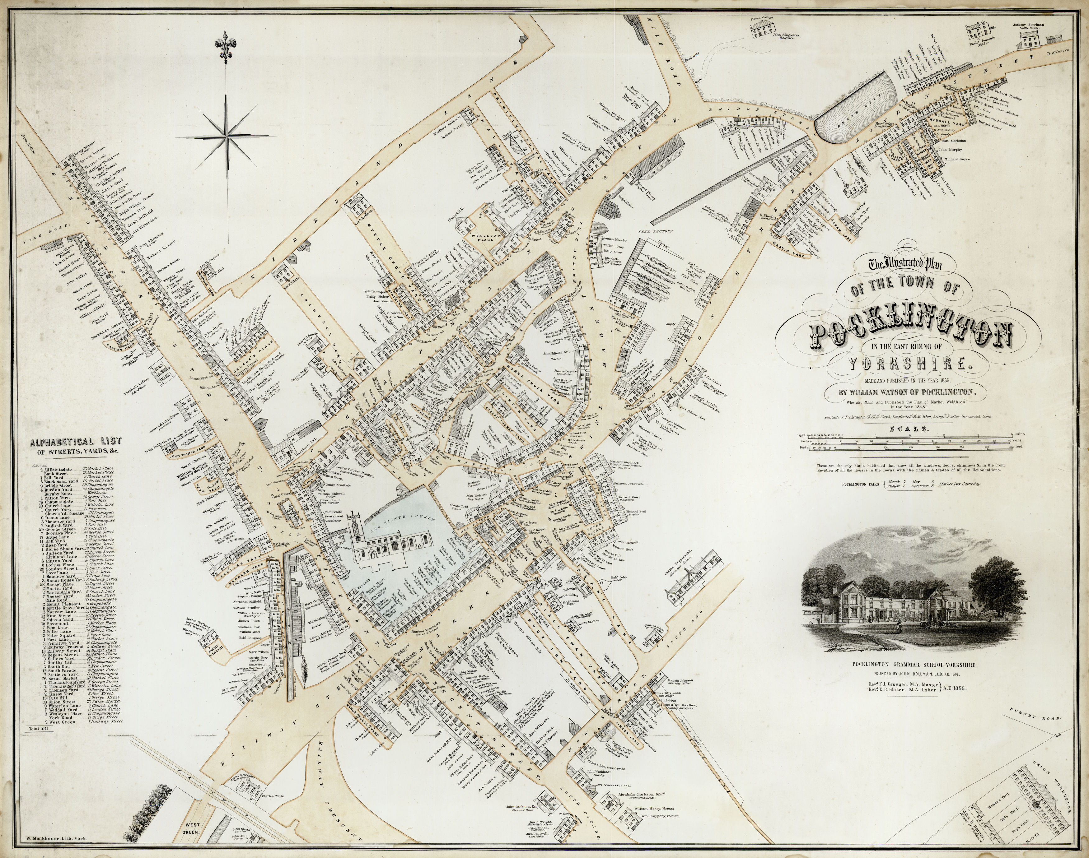
This later map of Pocklington was drawn in 1855 by William Watson, and has all the houses drawn with accurate representation of height, size, windows and doors. It also shows the main householder on the map itself. The maps are available for purchase from the Town Council.

n.b. To Zoom in to the map, hover over it with the mouse cursor, it may take a few seconds to load depending on the speed of your connection.
1855 MapLoading photo...